3D-Laserscan
The ideal starting point when using Layher SIM (Scaffolding Information Modeling) is a 3D model of the object at which the scaffolding is to be erected. In the case of historical buildings such as churches, bridge structures, etc., this data is often not available and this makes scaffolding planning difficult or sometimes impossible.
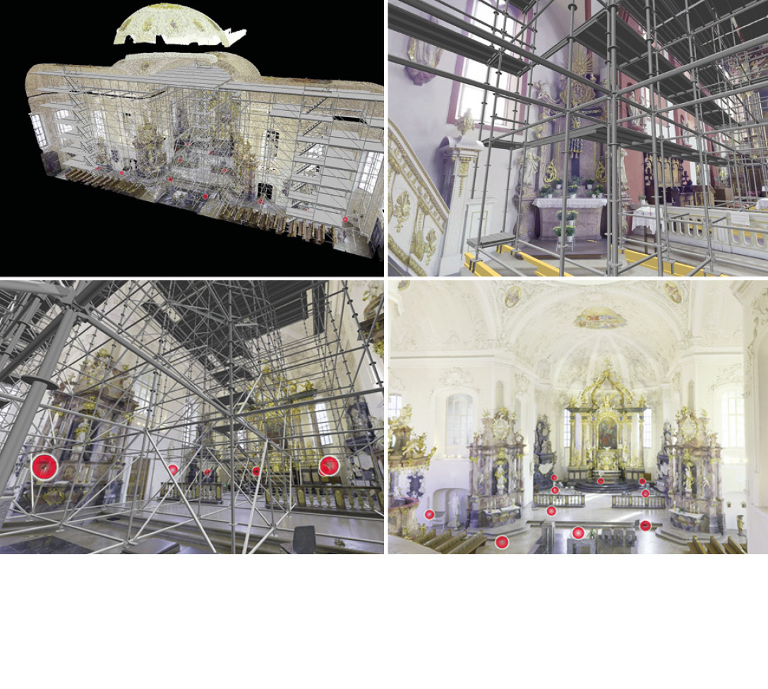
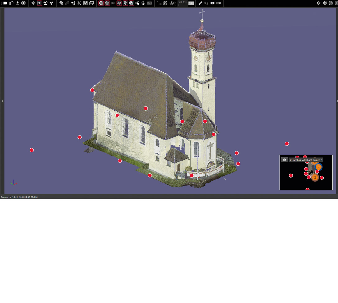
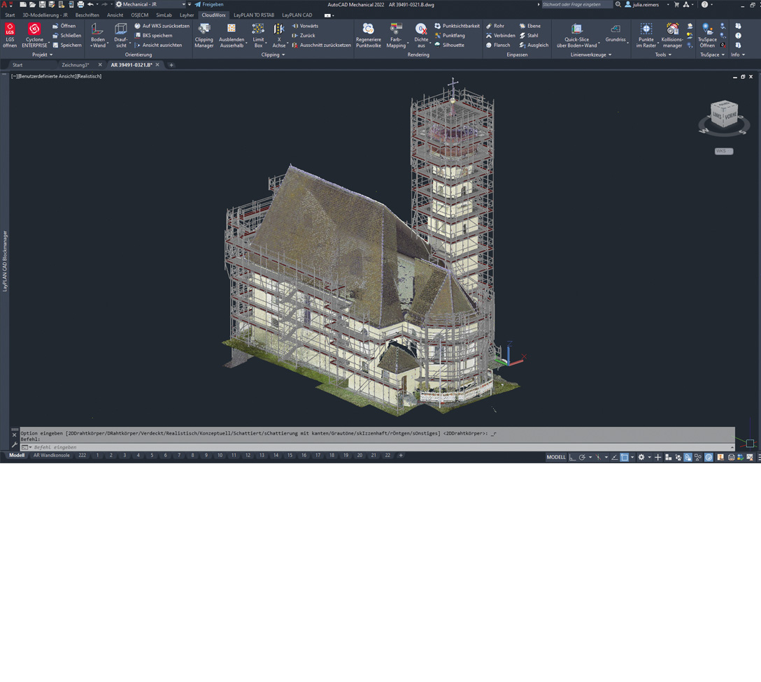
To make it possible to determine the actual state of these objects despite this problem, Layher offers its customers a digital surveying solution using a 3D laser scanner. The 3D laser scanner generates data of the current situation on site which is accurate to the nearest millimetre. This data is then used for scaffolding planning in LayPLAN CAD. In this way, scaffolding structures can be digitally adapted to the real current conditions on-site and optimised. Planning and checks performed on the digital twin ensure a high level of transparency and certainty during planning
with regard to materials, costs and deadlines, thus conferring an enormous competitive advantage.
- Scaffolding erected at historic buildings, churches, bridges, monuments, etc.
- Scaffolding at industrial installations, shipbuilding and aircraft scaffolding.
- Use in event technology for recording the environment at the event location.
- 3D laser scanners can be used indoors or outdoors and scanning is possible even in the complete absence of light (e.g. in a boiler).
The Benefits for You:
- Reliable geometrical data due to 3D surveying with millimetre accuracy
- Range approx. 100 m
- Can be used both indoors and outdoors
- Data preparation by Layher for use in LayPLAN CAD
- Integration in Layher SIM
- Certainty with regard to deadlines and costs during planning
- Scaffolding erectors who need digital surveys for the cases described here
- Knowledge of AutoCAD-/ BricsCAD and knowledge of the use of point clouds are required